Feb 26, 2022 | Terrabite » View recording
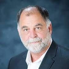
Speaker: Dr. George Mason, Center for Advanced Vehicle Systems,
Mississippi State University
A general discussion of the uses of mapping and geographical information systems (GIS) to build an off-road simulation environment. We present the typical input data fields for models such as the NATO Reference Mobility Model (NRMM) and websites that contain information useful in defining the attributes. We discuss some of the temporal and spatial issues and future work in GIS.
ISTVS has been hosting online events for research on terramechanics and terrain-vehicle systems under our Digital Event Series since 2021. Recordings from the series are posted to our YouTube channel. Make sure you’re subscribed to the ISTVS Newswire to keep up on upcoming events.
Speaker Bio
George Mason
Dr. George Mason worked for 33 years as a research engineer in the Mobility Systems Branch, Engineering Systems and Materials Division, Geotechnical and Structures Laboratory, as the Army’s lead researcher for studies on vehicle mobility. During that time, he acquired and managed over one million dollars in reimbursable funds for the U.S. Corps of Engineers, obtaining excellent ratings on my customer surveys. he managed a team of 15 to 20 engineers and technicians.
His work in mobility research was related to military areas, encompassing geospatial analyses, discrete element modeling of soils, and investigating vehicle/terrain interaction. The research required the application of advanced theories of soil physics and soil mechanics to quantify complex physical phenomena associated with the science and engineering of off-road vehicle mobility and the study of changes in associated surface geology. The R&D included developing new models, algorithms, and investigations into laboratory experiments to determine parameters affecting and altering the physical properties of soils that in turn support modeling of change detection and understanding the impact on vehicle mobility.
He completed his long-term training and Ph.D. with a focus on vehicle mobility and related studies of temporal and spatial changes in soil conditions. Upon completion of his Ph.D., he taught courses through MSU in geostatistics. He has been a guest lecturer at multiple universities including Colorado State University, Mississippi State University, Texas A&M, University of Alabama, Massachusetts Institute of Technology, and Rensselaer Polytechnic Institute. He extended the geostatistics studies to disturbed and undisturbed soils to solve problems related to finding buried mines and improvised explosive devices and modeling vehicle terrain interaction.


